Mixed Reality Visualization for Large Point Cloud Datasets
By Kyle Tanous
With the rise of advanced environment-mapping technologies such as LiDAR (using laser pulses to measure distances) and photogrammetry (reconstructing 3D data from overlapping images), we are creating remarkably detailed virtual models of our world. At the same time, Mixed Reality (MR) devices have emerged as intuitive platforms for exploring these data-rich representations, merging real and virtual elements into a single immersive experience.
Today, it’s possible to visualize massive point clouds—sometimes holding hundreds of billions of individual 3D points—by using efficient preprocessing techniques and data structures like octrees (as demonstrated by Schütz et al.). In these workflows, the “heavy lifting” of organizing the data is handled early, reducing the cost of rendering enormous scans in later, more frequent uses.
Preprocessing Lowers Costs
An analogy from automobile manufacturing shows why preprocessing matters. Crude steam-powered vehicles existed as early as 1769, but cars only became affordable and widespread when Ransom Olds and Henry Ford refined the assembly line. By shifting time and monetary costs into specialized infrastructure, they accelerated final delivery and lowered expenses.
A similar pattern is unfolding in telepresence, which seeks to give users a realistic sense of being in remote environments. Over the last few decades, prototypes evolved from basic setups to live 360-degree video and remote robotics. By systematically optimizing and consolidating data handling, telepresence can now scale to handle ever-larger datasets.
Consolidating computational effort up front makes telepresence practical for tasks ranging from engineering inspections to collaborative design reviews. With LiDAR or photogrammetry capturing the environment in advance, we spare user devices the burden of scanning, beginning the same kind of resource shift that previously transformed other pioneering technologies.
Boosting Scalability
In practice, two main avenues boost scalability. First, data representations like octrees provide a more memory-friendly way to deal with huge point clouds. Second, rendering techniques specialized for MR ensure billions of points can be displayed as a seamless, interactive scene.
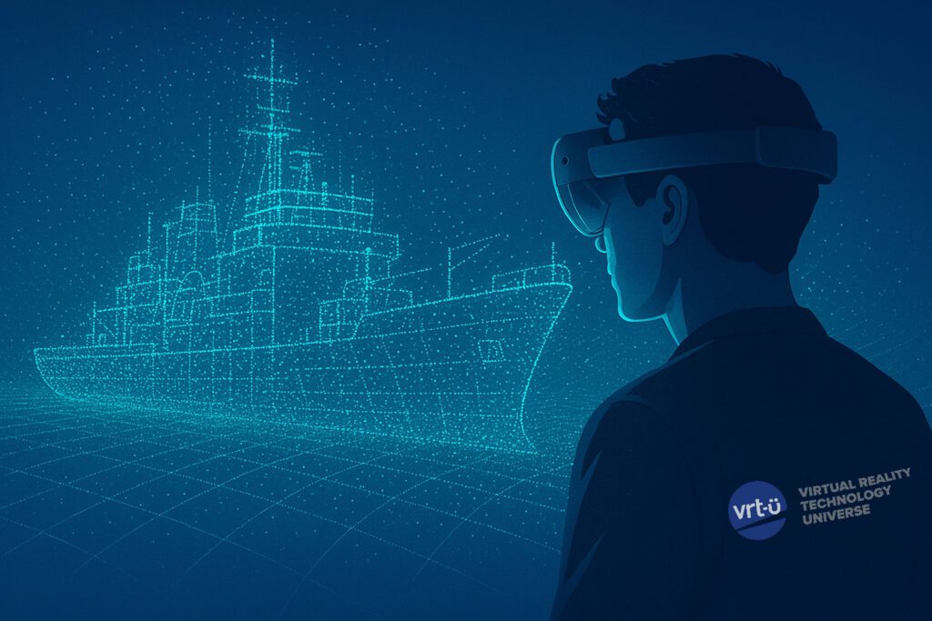
By reducing latency, emphasizing key regions, and offering intuitive navigation, these optimizations turn massive datasets into user-friendly experiences. Instead of wrestling with abstract data, engineers and technicians can virtually “walk through” detailed ship interiors or survey remote areas while maintaining smooth performance.
Mixed Reality
VRT-U, supported by experts in XR and user experience, aims to drive telepresence toward even greater functionality through MR. As the technology matures, we expect it to lower barriers for countless industries, enabling remote operation and inspection to expand well beyond niche use cases.
From ship maintenance and modernization to real-time engineering reviews, MR point cloud visualization lets geographically dispersed specialists meet in the same virtual space. A structural engineer, a naval architect, and an on-site technician could collectively examine a ship’s engine room in real time, diagnosing and resolving issues faster.
Ultimately, the key to widespread Mixed Reality telepresence is smart preprocessing and robust data structures that make massive point clouds manageable. As these advances continue, immersive collaboration will shift from a specialized tool to a standard practice, enhancing teamwork, efficiency, and our shared capacity to interact with the built environment.
Sources Cited:
Schütz, Markus, Stefan Ohrhallinger, and Michael Wimmer. “Fast Out‐of‐Core Octree Generation for Massive Point Clouds.” Computer Graphics Forum. Vol. 39. No. 7. 2020.