
AR-ECDIS: A Mobile Maritime Navigation Assistance System
AR-ECDIS: A Mobile Maritime Navigation Assistance System
An Electronic Chart Display and Information System (ECDIS) is a computer-based geographic information system used for nautical navigation. ECDIS provides continuous position and navigational safety information, as an alternative to paper navigation charts. The system generates audible and/or visual alarms when the vessel is in proximity to navigational hazards.
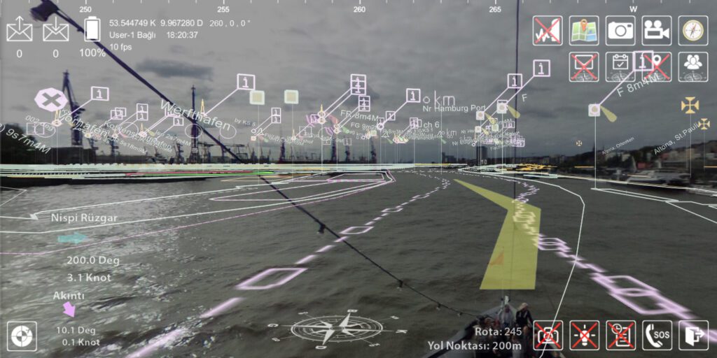
Augmented Reality integrated ECDIS (AR-ECDIS) could liberate the ship’s Officer of the Watch (OOW), providing panoramic 360-degree situational awareness. With AR-ECDIS, sailors can visualize ship’s route, course, speed, radar, guard zone, and many other vital information digitally overlaid to the real sea and terrain surface. The system also enables sailors to see 3D view of the terrain, and enhances command and control during night time or low visibility conditions. VRT-U is pleased to offer a smart-glass based AR-ECDIS solution. For more information, please contact us at https://vrt-u.com/contact